Saturday, 17 January 2009

Sleeping out in Antarctica 12/01/2009

Remember - if you want to see a larger version of any picture - just double click on it

Day 16 January 12th 2009

Last night we slept out in the Antarctic

Leif Island

Peninsula on an island in Leith Cove whose latitude and longitude are: 64.48.23.8 South and 62.52.21.8 West (approximately 100 miles north of the Antarctic Circle).

Zodiacs coming from Ioffe

We got there by zodiac from the Ioffe and with only one seal, a number of penguins and a few other intrepid travellers for company,

Briefing in how to build a snow hole

the first thing was a briefing on how to construct a snow hole.

Snow shoes for tamping down

Having donned snow shoes, dig a grave shaped hole (we dug a two person grave) pointed in roughly the direction from which you expect the wind/ snow / rain to come .

Hole dug and tamped

Put the excavated snow across the head of the hole so that the strong katabatic winds (which can arise at any time) are deflected over the top of the hole. Tamp the snow down whilst wearing the snow shoes so it is firm and flat.

Bivvy bags in snow hole

Place the floor mat inside a bivvy bag and the sleeping bag on top of the floor mat (also inside the bivvy bag.

Are youi sure this is a sensible idea

"Is this really a good idea?" wonders Pat.

Take as many clothes off as you want to, stuff them inside the bivvy bag with your

Pat in bed

sleeping bag so that they do not get wet and get inside.

We got some (but not a lot of) sleep during the night and it was not too cold - hovering just below zero. Throughout the night there was the sound of avalanches nearby and glaciers calving although we did not have to worry about the resultant tsunami because we were way above the water line.

 Paul in Bed

Mrs Yum-Yum got some use during the night. Although an outside loo with very bare facilities

Mrs Yum-Yum

the view when you looked out of the window was magnificent.

The view from the loo (Mrs Yum-Yum)

The view at dawn was quite something, and certainly very few people have seen dawn from where we were. Dawn however is a slightly incorrect concept here because although it got slightly less bright during the night, it was light enough to read by the whole night.

Dawn View

We were rescued around 6 am and after breakfast and a hot shower, spent the morning in bed.

Overall, we thought this was a very special and amazing thing to do, but not something for every night!

We are both given a certificate to commemorate our courage

Camping Certificate

This says: "This certificate is awarded to Paul (Patricia) Harvey in order to honour the adventurous spirit that inspired you to spend the night on the ice in Leith Cove off the Antarctic Peninsula".

This afternoon we are going to Port Lockroy which lies on the western side of Wiencke Island in the Palmer Archipelago and is comprised of Jougla Point and Goudier Island. Goudier Island is home to a restored British Antarctic Survey (BAS) hut, Bransfield House. The hut was occupied between 1944 and 1962 and research carried out at this site focused on surveying the region and its geology, meteorology and botany. After 1950 this switched to ionospheric research. At Jougla Point there is a large gentoo penguin colony and a colony of shags. A reassembled baleen whale skeleton can also be found close to the landing site.

We are now leaving the region of large bergs and looking outside of the window we can see one of our last large bergs.

Our last iceberg

From now on it will be bergy bits and brash and in a few hundred miles, just cold sea.

The approach to Port Lockroy (64 49s 63 30w) is through the Neumeyer Channel which is very spectacular -

Moody Mountains (1)

Moody Mountains (2)

lots of moody mountains with a heavy sky. The base has been restored as a museum to

Port Lockroy Kitchen (kitchen)

Port Lockroy Larder (1) (larder)

Port Lockroy Larder (2)

Port Lockroy Larder (3)

Port Lockroy Living Quarters (living quarters)

Port Lockroy Office (office)

the work of early Antarctic scientists and showing how they lived. It is open to any passing public for around four months a year. It is also the southern most public British Post

THe Union Jack flies over Port Lockroy

Office in the world - passing ships such as the Ioffe pick up mail and take it to Stanley in the Falkland Islands for onward transmission.

Nearby Jugla Point has yet more Gentoo penguins, here showing how they seem to spend most of their life collecting stones (Love Rocks)

Love Rock (1)

Love Rock (2)

Love Rock (3)

both small and large to put on the nest of their loved one. They also steal stones from nearby nests. The chicks here are much

Yet another Gentoo and Chick

further on than those we have seen further south.

On the beach is an assembled skeleton of a

Whale Bones

whale, created to show us how big one is.


Friday, 16 January 2009

We land on the Antarctic Continent 11/01/2009

Remember - if you want to see a larger version of any picture - just double click on it

Day 15 January 11th 2009

The Travel Teddies land on their seventh continent

Travel Teddies make their seventh continent

Neko and Paradise Harbour

Neko Harbour lies on the eastern shore of Andvord Bay, approximately 11km south of the Errera Channel. It was discovered by de Gerlache during his Belgian Antarctic Expedition of 1897-9. It is named for the floating whale factory ship Neko, which often used this bay. Neko operated between 1911-12 and 1923-4 in the South Shetland Islands and Antarctic Peninsula. This site is on the Antarctic continent and home to approximately 250 breeding pairs of Gentoo penguins, some of which nest around the Argentinean refuge hut.

Paradise Harbour was named by whalers for its protected anchorage and beautiful views. The plan is to zodiac cruise this spectacular waterway, exploring the ice and shoreline to where the Petzval Glacier meets Antarctic waters in Skontorp Cove, a picturesque little  bay almost completely composed of ice and ocean. A landing will be made on the Antarctic continent at Almirante Brown (an unoccupied Argentine research station). If conditions allow, we will hike up the steep hill behind Almirante Brown for the stunning views of the surrounding area and the opportunity to slide down the hill. Wildlife found on the steep cliffs of Paradise Harbour includes nesting blue eyed shags, pintados and Antarctic terns. Marine mammals are often spotted in the ice filled waters.

Eating in the Antarctic has become something of a challenge – the challenge being coping with the quantity of food offered during the day. The ship has been chartered by an American company and therefore the food available during the day has been measured to match American views of portion sizes and meal frequency. A typical day’s menu is as follows:

Pre-Breakfast:

Cakes, tea, coffee

Breakfast:

Seven Types of cereal, fruit, numerous juices, porridge, full cooked breakfast plus the chef's special (today it was French Toast, yesterday apple pancakes and the day before, three cheese omelette), toast

Elevenses:

Freshly baked cakes, tea, coffee etc

Lunch:

Salad, soup, one of Pizza or Smoked Salmon with accompaniments, gateau or cheese and biscuits

Tea:

Freshly baked biscuits; tea, coffee

Happy hour:

Hors d’oeuvre (to have with the special drink of the day)

Dinner:

Soup; Salad; Farm-Raised Fillet of Venison or Sole Francaise or Zucchini Cakes; Chocolate Moulton Cake or Cheese and Biscuits.

Portions are massive and even asking for a half portion produces more food than a normal person can eat. Many of the British contingent have given up attending lunch, simply in order to carry on fitting into their clothes.

Never-the-less, because this is such an active holiday and the extreme weather consumes calories very fast, meal time has become a welcome event. Towards the end of each meal, the guides usually insert a briefing on something about to happen, or an educational review of something which has happened and sometimes a gentle anonymous telling off for anyone who has transgressed one of the rules regulating Antarctic behaviour.

Hygiene (and the perils of poor hygiene) are taken very seriously and we are all expected to disinfect our hands before entering the dining room.

The sea is flat calm as we approach Neko Harbour and so a repeat attempt for the quiet contemplative zodiac excursion is planned.

Neko Harbour

The harbour (really a nice looking bay) is magnificent although ice is said to be a big

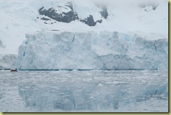
Glacier which calves

risk because of a large glacier nearby which regularly calves. To us the glacier looks large,

Ioffe dwarfed by glacier

it being 200 metres or so across but apparently they are up to 200 km long on the Ross Ice Shelf. The captain is very nervous of the ice, partly because there is a lot around and also because last year it sunk one ship and this year has damaged another.

The sea is flat calm so we have another go at the quiet zodiac trip and this time it is a total success. We get well out into the bay and then drift in absolute quiet, the only sounds being the sea, the wildlife, avalanches in the mountains and calving glaciers (the sound is a long rumbling like a heavy steam train).

Weddell Seal

There is a Weddell seal on a nearby floe and it is absolutely disinterested in us. We are so close that we can see individual whiskers and

Weddell Seal Head

hear it sigh occasionally as it sleeps. There are the usual spectacular bergs around,

A Berg

mainly coming off the glacier. When we get

Ioffee in Neko Bay

onto land, we are actually on the Antarctic Continent as against being on one of the islands. We promptly set off to march up the hill to have our pictures taken with the Travel Teddies who have now clocked up their seventh continent.

On the way down, we see part of the glacier actually calve and the mini tsunami which it creates, work its way across the bay.

Even though we are in one of the remotest parts of the world, there are still people who are prepared to travel there in the most unlikely of craft.

Small Yacht in Paradise Harbour

This yacht was spotted near Paradise Bay, crossing the Drake Passage in it is a horrible thought.

The guides with us said that they thought Paradise Bay was the loveliest of all of the places they visit in the Antarctic. It was certainly beautiful and spectacular with some of the largest glaciers we have ever seen.

Almirante Brown Station (1)

At the head of Paradise Harbour is Almirante Brown station, usually unoccupied but today the maintenance men have called to make some repairs, so unusually, it is occupied.

Lichen growing on rocks

Even though this is Antarctica, there is still some plant life. Lichen is growing (very very slowly) on these rocks.

Copper Deposits showing

Evidence of copper deposits in the area is shown by the copper oxide streak on the rocks, hence the continuous political interest in Antarctica.

Chinstrap Penguin

We find our first Chinstrap Penguin, looking as comical as they are reputed to do.

Pat and Paul on a zodiac Paradise Harbour

The zodiac takes us to some astonishingly thick glaciers, this glacier is 100m thick at the water's edge.

Ice and snow 100m thick

Calving goes on constantly and these blocks are due to do that any moment.

Glacier about to calve

Glacier blocks 

When they have calved they become icebergs - size can be estimated using the zodiac for scale.

Glacier with zodiac

Generally, the landscape here is as massive and astonishing as usual.

Paradise Harbour Glacier

Paradise Harbour - glacier reflection

Paradise Harbour - the sun comes out

Tonight after supper, we go camping. The guides have been doing the best to dissuade people from doing it by emphasising the hardships, the damp, the toilets, the............ anything they can think of to put people off.

We are still going though !


Iceberg Graveyard 10/01/2009

Remember - if you want to see a larger version of any picture - just double click on it

Day 14 January 10th 2009

One of the issues which is focusing the collective mind at the moment, is flying back from Ushuaia to anywhere. Most people are book on Argentina Aerolineas (or one of its variations) and everyone has their tale to tell of cancelled flights, re-routed flights, lost bookings etc. We now count ourselves lucky that our flight time was only changed three times and the airport changed once. The worst delay we have heard of is 2 ½ days together with a refusal (in a Spanish manana way) to issue any written confirmation of the delay so that a claim for costs could be made on travel insurance. The airline has such a bad record for loosing luggage that the ship asks for donations of unwanted clothes to keep in store for the regular arrival of travellers without their luggage. We were asked to supply our tickets details to a ground agent in Ushuaia before we left and the theory is that they will confirm our flights and get boarding cards or take appropriate action to deal with whatever surprises the airline come up with. Whether that works or not will be revealed when we get back to land.

Petermann and Pleneau Islands

Petermann Island lies just below the Lemaire Channel southwest of Hovgaard Island, in the Wilhelm Archipelago. It was discovered by the Dallman expedition of 1873-4 and named after August Petermann, a German geographer and supporter of polar exploration. The French explorer Jean-Baptiste Charcot and his vessel "Pourquoi Poi?" over-wintered here in 1909. Charcot named the small cove on the southwest side of the island Port Circumcision for the fact that he discovered it on January 1st and named it for the Feast of the Circumcision. On the beach near the cove is an abandoned Argentinean refuge hut built in 1955. There is also a memorial cross nearby for three British scientists who died near here in August 1982. Petermann Island is home to Adelie penguins (500 breeding pairs), the most southerly colony of Gentoo penguins in Antarctica (2000 breeding pairs) and blue eyed shags. Grass and moss can also be found on the northern section of the island once snow melts. There are stunning views from Petermann island both looking north towards the Lemaire Channel and south to the mountainous landscape of Graham Land.

Pleneau Island is a small (1,28 km) low island lying to the west of Booth Island and north of Hovgaard Island. It was originally charted by Charcot during his 1903-05 French Antarctic Expedition and named for the expedition's photographer, Paul Pleneau. The island is home to more than 500 breeding pairs of gentoo penguins as well as south polar skuas and kelp gulls. The shallow waters north and west of the island are known as an "iceberg graveyard" due to the number of large old bergs that often get forced into the shallows by the wind and currents, and remain trapped and grounded until they break up.

A great morning observing Penguins, one seal and a nice bit of walking in rather thick snow. The scenery was stunning. It rained a fair bit but that did not spoil the morning.

Explorers and Iceberg graveyard

We saw our first Adelie penguin, whilst many

Adelie Penguin

of the colonies are mixed breeds, the Adelies

Gentoo Colony

here have declined on this island from 80% to 20% over the past few years. It is said that this is a consequence of climate warming because Gentoos like slightly warmer climates and therefore as the peninsula gets warmer, they take over the breeding grounds. Gentoos tend to be very curious about humans and will come up and look at you in a most quizzical way whereas Adelies just get on with life and totally ignore you.

There are many chicks (both Adelie and

Adelie Chick

Gentoo) about in various stages of development. Some are still furry whilst others are into first feathers.

Gentoo and chicks

The penguins tend in the main to follow set tracks when walking around

Penguin Track and Refugio

the island and the tracks are usually stained a pink / purple colour from the krill they eat, the remains of which they deposit as they walk.

On the island, there is a Refugio for use in

Argentine Refugio

emergency and also a memorial to the three British scientists who disappeared on the

Memorial to three dead scientists

island in 1982 (and are now presumed dead). The beauty of the scenery is again too large for a single picture to convey.

The Antarctic Treaty visitor guidelines for Petermann Island are at http://www.ats.aq/siteguidelines/documents/pdf_ingles/Petermann_ingles.pdf

We have signed up for the afternoon "silence zodiac trip". The idea is that we go far out into the Antarctic sea in a Zodiac, find a nice quiet spot, turn the engine off and just enjoy the Antarctic silence or noises or whatever animals come to visit us. Nobody has ever done this before on one of these trips and the guides are somewhat curious as to how it will turn out.

Well, in the Antarctic, nothing works out as planned. Having got into the zodiacs, the snow started coming down quite hard, the sea got up and we were soon soaking and very cold. So it was rapidly decided that we would "contemplate" another day and just look at icebergs this afternoon.

If ever you wanted to set up a second hand iceberg shop, this would be the place to do it. We are moored at the head of a very long cove and as you zodiac into it, you come across approximately100 old icebergs

Iceberg Graveyard (1)

of all shapes and sizes.

Iceberg Graveyard (3)

Iceberg Graveyard (2)

This one is about 60 metres tall and therefore

Massive Iceberg

has about another 540 metres below the water. A rough estimate gives it about 6,000,000 cubic metres of fresh water (enough to provide the average household in the UK with fresh water for 800 years).

Glacial Iceberg

This is a remnant of a glacier, one can tell that from the rocks and soil on the surface of the ice.

Window through an Iceberg

This one is about to calve and that is why you can see two more icebergs behind through the window in the ice.

As we wait for dinner and also sailing north through the Lemaire Channel which is one of the greatest spectacles in Antarctica, outside of the window pops up a wonderful mountain view.

Mountain at mouth of Lemaire Channel

We went onto the Bridge for the Lemaire Channel experience. There was a certain amount of tension present as the Captain slowly took the Ioffe through the Channel (about 7kms long). It is narrow at its entrance

Entrance to Lemaire Channel

and exit

Exit from Lemaire Channel

and in order to avoid underwater rocks and icebergs near the exit, the ship has to perform a strange 360 degree rotation in the middle of the channel in order to effectively move sideways as it approached the exit.